Adding an Import from mesh node
This node creates a terrain from a 3D mesh file.
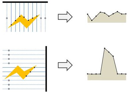
The mesh is transformed into a heightmap by computing a depth projection according to a viewing vector. A simple analogy would be to imagine that we scan the mesh with a moving laser and use the measured distance between the capture plane and the mesh as the value of the heightmap. The laser position and direction can be decided between six fixed projection directions (i.e. ± X, ± Y, ± Z axis). Both the grid size and the cell size are given by the user.
Note that as the width, height, and cell size parameters specify what rectangular area we want to capture and since the mesh is defined in world space, only empty space can be captured.
To add a node, right-click in the Graph Editor and select Create Node > Import > Import from mesh.

Double click on the node to open its parameters:
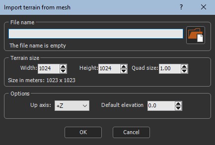
Importing a terrain from a mesh
To import a terrain from a mesh:
- File name: Either drag and drop the file into the File name field, click on the folder button and browse to the file you want to import, or type the directory of the file to import.
If you have already saved your project, type just a file name or sub-directory and file name to import it from the same directory as your project. There is no need to type the file directory.
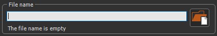
File names with Unicode characters are supported.
The following image formats are supported:
| Extension | Format | Comments |
|---|---|---|
| .fbx | Autodesk FBX Format | 2014 and 2016 versions |
| .obj | Wavefront Format |
Note that if the image has an alpha channel, it is discard and transformed to white.
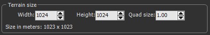
- Terrain size: Displays the Width, Height, and Quad size of the terrain.
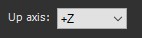
- Up axis: Sets which axis to use to measure the elevation.
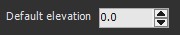
- Default elevation: Sets a default height of points on the grid that do not project onto the mesh.
Parameters
| Parameter | Use |
|---|---|
| File name | Name of the mesh file to load |
| Terrain size | Displays the width, height, and quad size of the mask |
| Consider direction as the elevation axis | Sets which axis to use to measure the elevation |
| Fill with value | Sets a default height to points of the grid that do not project onto the mesh |