Adding an Import terrains from several files node
This node is available for the Pro edition only.
This node creates terrains from a set of RGBA files. The size and gray scale of each image is treated in the same way as for the Import terrain from a file node. This node uses the same operation as the Import terrains from several RGBA files node for file management. Instead of entering a filename, a formula is entered, which is used to determine the name of each file.
To add a node, right-click in the Graph Editor and select Create Node > Import > Import terrains from several RGBA files.
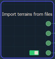
Double click on the node to open its parameters:
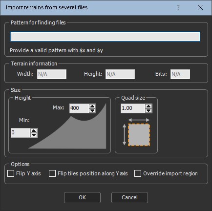
Importing terrains from several RGBA files
To import terrains from several RGBA files, set the following parameters:
- Pattern for finding files: This is the formula used to retrieve the files to load. Copy and paste the directory containing the terrains you want to import (see Explanation about the formula for more details).
- Quad size: Sets the terrain quad size.
- Terrain information: Sets the Width, Height, and Bits of the terrain.
- Height: Sets the minimum and maximum height of the terrain.
- Flip Y axis: Check the box to flip the terrain around the Y axis.
- Flip tiles position along Y axis: Check the box to flip the position of the tiles along the Y axis. The files with the smallest Y axis are at the bottom, and the files with the largest Y index are at the top. The X axis does not change.
By default, the part corresponding to the first file (for example, file (1, 1)) is at the top left of the field and the last file (for example (4, 3)) is at the bottom right of the field. It means we go down when the index Y increases.
- Override import region: Check the box to override the import region if you want to specify the files to load; otherwise, Instant Terra detects the files to load automatically.
For example, if you have 12 files, you can load only some of them, (1, 1) up to (2, 2).
- Click OK to load the terrain files.
Parameters
| Parameter | Use |
|---|---|
| File name | Name of the file to load |
| Quad size | Size of the terrain quads |
| Terrain information | Shows the width, height, and bits of the terrain |
| Flip Y axis | Flips the terrain around the Y axis |
| Flip tiles position along Y axis | Flips the position of the tiles along the Y axis |
| Override import region | Overrides the import region to specify the files to load |