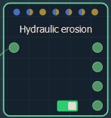
Adding a Hydraulic erosion node
The Hydraulic erosion node creates realistic erosion and deposition effects caused by rainfall and river flows.
This simulation follows three basic rules:
- When water flows over terrain, it erodes it by carving rivers or at least weathering the slopes
- As water flows downhill, it transports the eroded material with it
- As the water settles out, it releases the suspended soil particles to create sediment depositions.
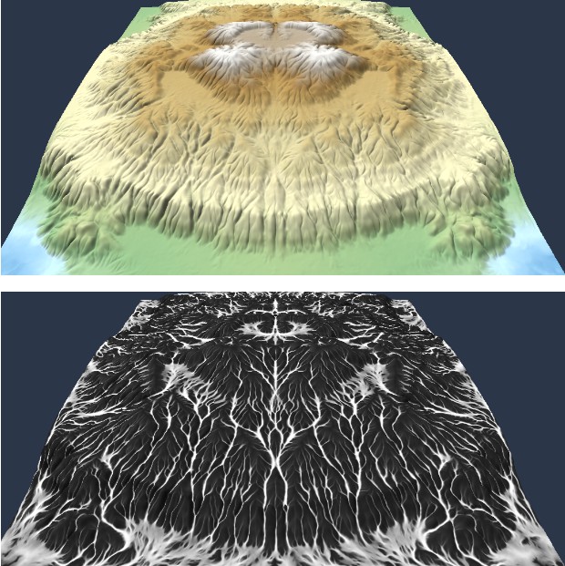
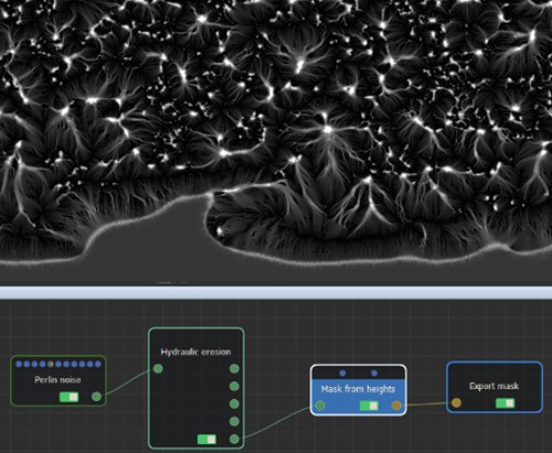
The following image shows the hydraulic simulation and its corresponding flow map.
To add a Hydraulic erosion node, right-click in the Graph and select Create Node > Simulation > Hydraulic erosion.
The connectors from top to bottom correspond to:
- The eroded terrain
- The sediment elevation
- The water elevation
- Water accumulation
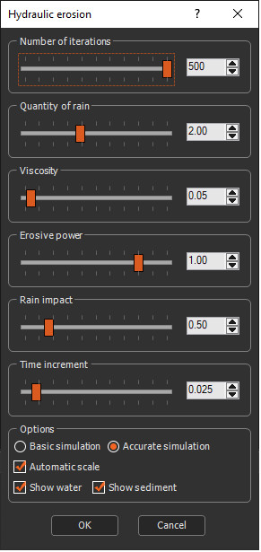
Double click on the node to open its parameters:
Editing a Hydraulic erosion node
- Number of iterations: Sets the number of iterations.
- Quantity of rain: Quantity of falling water, in centimeters per second.
- Viscosity: Change the fluid behavior and thus the erosion pattern. Note that a low viscosity fluid requires as a smaller time increment.
- Erosive power: The higher the value, the more terrain will be eroded by the flowing water.
- Rain impact: Quantity of rock shattered by rain and transformed into sediment.
- Time increment: Time that elapses between iterations, in seconds. If this value is too high, the simulation may diverge and give incorrect results. The usual range of values is between 0.010 and 0.150 s (i.e. between 10 ms and 150 ms).
- Show water: This option is checked by default. Uncheck the option to view erosion without displaying any water on your terrain.
- Show sediment: This option is checked by default. Uncheck the option to view the node without displaying any sediment.
- Simulation mode:
- Basic simulation: Simpler and faster algorithms. Use this mode for compatibility with data created before version 1.7.
- Accurate simulation: Provides a robust simulation that avoids alignment patterns.
- Automatic scale: The result of the Hydraulic
erosion node has been optimized for a terrain whose quad size
(resolution) is equal to 1 meter. When the quad size is more than 1
meter or less than 1 meter, the node is more difficult to adjust
and may give inferior results. The Automatic scale option overcomes
this difficulty to obtain results of the same quality, whatever the
quad size.
The option is enabled by default. It is advisable to leave it enabled, except for users who are familiar with the various parameters of the erosion node.
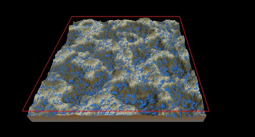
The tile being calculated is highlighted and surrounded by a red frame. This is only visible if the erosion parameters window is open.
Exporting the flow map
To export the flow map of the hydraulic erosion:
- Link a Mask from heights node to the Water accumulation output connector.
- Configure the Mask from heights node as an automatic gradient.
- Link an Export mask node to export the flow map.
Parameters
| Parameter | Description |
|---|---|
| Number of iterations: | Sets the number of iterations |
| Quantity of rain: | Quantity of falling water, in centimeters per second |
| Viscosity: | Change the fluid behavior and thus the erosion pattern |
| Erosive power: | The higher the value, the more terrain will be eroded by the flowing water |
| Rain impact: | Quantity of rock shattered by rain and transformed into sediment |
| Time increment: | Time that elapses between iterations, in seconds |
| Evaporation mask: | Quantity of evaporated water, in percentage per iteration |
| Deposition mask: | Acts as a localized sediment sink, allowing the user to erode without sediment transport |
| Simulation mode: | Change the algorithm to use either 4 or 8 neighbors for the water flow |
| Show water: | Uncheck the option to view erosion without displaying any water on your terrain |
| Show sediment: | Uncheck the option to view the node without displaying any sediment |
| Automatic scale: | Automatically scales the terrain so that the result has the same quality as a terrain with a quad size of 1 meter |
Some combinations of the Advanced parameters may lead to a divergent simulation.