Adding a Multi-scale erosion node
The Multi-scale erosion node erodes the terrain at different scales. It can erode the terrain more significantly than the Hydraulic erosion or Thermal erosion nodes.
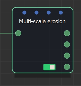
The node has four outputs:
- The eroded terrain
- The height of the sediment
- The depth of the water
- The cumulative water height
To add a Multi-scale erosion node, right-click in the Graph Editor and select Create Node > Simulation > Multi-scale erosion or press the keyboard shortcut NMSE (Node Multi-Scale Erosion).
Double click on the node to open its parameters:
Editing a Multi-scale erosion node
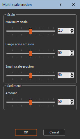
To edit the Multi-scale erosion node, use the sliders to set the following parameters:
- Maximum scale: Defines the maximum scale of erosion, between 1 and 3. When this parameter is equal to 1, only one level of erosion is calculated. We achieve with a result close to that obtained with thermal erosion followed by rock erosion. When this parameter is greater than 1, for example when it is equal to 2 or 3, we achieve two levels of erosion: a first level of erosion that works on a scale 2 (respectively 3) times larger, and then erosion at the usual scale.
When the maximum value 3 is used, terrain details may be slightly lost.
- Large-scale erosion: The intensity of erosion on a greater scale.
- Small-scale erosion: The intensity of erosion on a smaller scale.
- Sediment amount: Quantity of sediment produced by erosion.
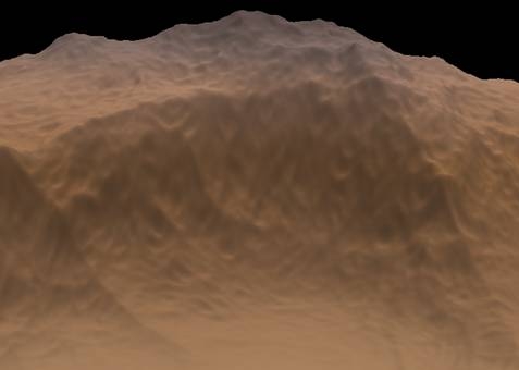
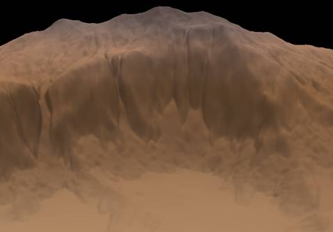
Example
Here is an example of result obtained using the Multi-scale erosion node.
The input terrain before erosion:
The output terrain after erosion:
Parameters
| Parameter | Description |
|---|---|
| Maximum scale | Defines the maximum scale of erosion, between 1 and 3. |
| Large-scale erosion | Intensity of erosion on a greater scale. |
| Small-scale erosion | Intensity of erosion on a smaller scale. |
| Sediment amount | Quantity of sediment produced by erosion. |